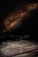
Specific stars and constellations are used by some Aboriginal language groups to help them remember key waypoints along a route, detailed oral histories reveal. The research, reported in the Journal of Astronomical History and Heritage, documents how people from two language groups in north-central New South Wales and south-central Queensland use the night sky.
Friday, 11 July 2014 Genelle Weule ABC
Professor Ray Norris of CSIRO Astronomy and Space Science and Bob Fuller and colleagues from Macquarie University collected stories from Euahlayi and Kamilaroi people including Kamilaroi elder Michael Anderson.
"A while ago I was contacted by a Kamilaroi man who had seen some of our work and wanted to tell us some traditional stories.
"They're working with us to rebuild their language and we're collecting the astronomy.
"During this process we discovered that there's this fantastic store of knowledge about how people navigated."
The two language groups have a long history of using the position of features in the sky such as the Milky Way to predict when resources such as emu eggs are available.
While some Aboriginal groups travel at night using stars as a compass, it was thought that the Euahlayi and Kamilaroi people, who did not travel extensively at night, did not use the night sky for navigation.
But the stories of the Kamillaroi and Euahlayi people provide the first evidence of how they use star maps to teach travel routes based on songlines.
"We've known for a long time that Aboriginal people have these songlines where the songs describe the features of the land.
"And we've known that [some Aboriginal groups] use the stars as a compass.
"But then people talk about these journeys that you can see in the sky but it's never quite clear about how that maps onto the songlines on the ground.
"For the first time we are actually hearing the details of how this actually works.
"We've never been able to map one onto the other like this before."
Star maps
Rather than use stars as direction points, the Euahlayi and Kamilaroi elders use the stars as a reminder of where songlines go, often months before they travel to their destination.
"In some cases people have these songlines with the words of the song telling them how to navigate, but they also identify places on the ground with places in the sky," says Norris.
The songlines covered thousands of kilometres, with one example going from Heavitree Gap near Alice Springs in central Australia, all the way across to Byron Bay on the New South Wales east coast connecting the Arrenrte people to the Euralayi people.
The songline is marked in the sky by the star Achernar in the in the West overhead to Canopus, to Sirius, and then to the east.
"Songlines cross over the lands of many different Aboriginal groups, and each has their own bit of the song in their own language," says Norris.
"Someone from the east will recognise a specific star songline right across Australia, even though it's not in their language."
Although massive songlines exist right across Australia, Norris says it is not known if they use star maps the same way as the Euahlayi and Kamilaroi people.
Further research on the use of other star maps for travel by other language groups, particularly other language groups that may have met the Euahlayi peoples, may lead to a clearer understanding of the Aboriginal use of the night sky for travel, say the researchers.

